Hi @JHH I have sent the latest FW version to your email. Please do let me know if you have received the FW package. For LC29HBA, can you specify the usage for 2-wheel or 4-wheel?
Hi @JHH the differences between 2-wheel and 4-wheel configurations are primarily defined by dedicated firmware versions optimized for the specific dynamics of the vehicle.
1. Firmware and Functional Differences
Quectel provides two distinct firmware versions for these modules to account for different movement patterns:
Four-wheel version: Optimized for cars and similar vehicles.
Two-wheel version: Optimized for bicycles, scooters, and motorcycles.
Feature/Message
4-Wheel Support
2-Wheel Support
PQTMVEHATT (Attitude: Roll, Pitch, Heading)
Supported
Not supported
PQTMVEHMOT (Motion Status/Detection)
Supported
Not supported
PQTMODO (Odometer Version 2)
Supported
Not supported
PQTMCFGIMUTC (Temp Compensation)
Supported
Not supported
PQTMINS/PQTMIMU/PQTMGPS
Not supported
Supported
PQTMCFGSTATICHOLD
Not supported
Supported
2. Dead Reckoning (DR) Performance
The expected positioning error when GNSS signals are lost is higher for 2-wheelers due to their more complex dynamics and vibration profiles:
ADR Position Error: < 2% for 4-wheelers vs. < 4% for 2-wheelers .
UDR Position Error: < 3% for 4-wheelers vs. < 6% for 2-wheelers .
3. Installation and Mounting Constraints
Mounting Flexibility: Both support free mounting with no angle requirements. However, for 2-wheelers , mounting on the handlebar is explicitly discouraged as it degrades performance due to excessive vibration and movement. Mounting on the vehicle’s deck or frame is preferred.
Speed Data Injection: For 2-wheelers using ADR, speed data should ideally come from the rear wheel if the module is deck-mounted, or the front wheel if handlebar-mounted.
Default Hot Start: The default <Mode> for the $PQTMCFGDRHOT command is 0 (Disabled) for 2-wheel firmware, whereas it is 1 (Enabled) for 4-wheel versions.
4. Message Behavior
Disabling Status Messages: The 4-wheel firmware allows users to configure or disable the PQTMIMUTYPE and PQTMDRCAL output messages. In contrast, the 2-wheel firmware does not allow disabling these messages; they are output by default.
Vehicle Message Versions: For the PQTMVEHMSG command, 2-wheel firmware only supports Message Versions 1 (speed) and 2 (wheel ticks), while 4-wheel firmware supports additional versions for multi-wheel speed data.
Hi @JHH, if your requirement is primarily for a reliable external GPS source for standard Android applications, without the need for high-precision positioning or dead-reckoning capabilities, the LC29H(BA) variant may not be the most suitable option for your use case.
I needs the high-precision gps. So, I also try the lg290p.
But I find the DR commands are not the standard NMEA command. So the app can not recognize. I also not use rtk. Or are the DR informations including in the NMEA command? or other standard formate?
Hi @JHH for DR and RTK are another type of application and there is documentation for this application.
Here is the detailed breakdown of why DR and RTK may not a good option and what variant you should consider instead:
1. General Apps and “DR Data” Recognition
Standard Android applications (and the Android Location Service itself) are designed to parse standard NMEA 0183 sentences like $GNGGA and $GNRMC .
Proprietary Messages: The specialized Dead Reckoning (DR) data (such as vehicle attitude, sensor raw data, and calibration status) is output via proprietary PQTM messages like $PQTMDRPVA or $PQTMDRCAL . Most general apps will not recognize or use this extra information.
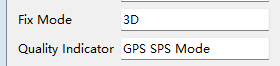
Fused Position: While the module does “fuse” the DR data into the standard NMEA sentences to provide a continuous position in tunnels, it often flags these as “Estimated/DR” mode (e.g., a ‘2’ or ‘E’ in the mode indicator). Some simple apps might even reject these fixes if they are only looking for a “GNSS-only” fix quality.
2. The Hardware Complexity of DR
The DR features in the LC29H(BA) and LC29H(CA) variants are not “plug-and-play” for a simple external GPS setup:
Rigid Mounting Required: To use DR, the module must be firmly and rigidly fixed to the vehicle frame. Any relative movement or vibration will cause the calibration to fail.
Calibration Process: You must perform a specific self-calibration procedure (driving at speed and performing 90-degree turns) every time the installation orientation changes.
Speed Input: For the best performance (ADR), the module requires a vehicle speed signal (wheel ticks or UART speed messages). Without this, it defaults to UDR, which has significantly higher error rates.
3. Recommended Variant: LC29H(AA)
For your specific application (external GPS source for an Android app), the LC29H(AA) is the more appropriate choice:
Standard Dual-Band: It provides high-quality L1 + L5 dual-band positioning, which significantly improves accuracy in urban canyons by mitigating multipath effects.
Simplicity: It provides standard NMEA output without the overhead of DR or RTK engine management.
Plug-and-Play: You can use it as a “handheld” or loosely placed receiver without worrying about sensor alignment or IMU calibration.
The LC29H(AA) does support the QZSS L1S band for the Sub-meter Level Augmentation Service (SLAS) . This feature is specifically restricted to the AA variant (and the LC79H AL) and is not available on the DR or RTK variants like BA or CA.
If you have enabled the setting but the module cannot find the satellites or apply the positioning, the issue is likely due to one of the following configuration or environmental requirements:
Mandatory Configuration Commands:
Simply enabling SLAS is often insufficient; you must also configure the module to prioritize SLAS as its differential correction source.
Enable SLAS Search:$PAIR420,1*21 .* Set DGPS Source to SLAS: You must tell the module to use SLAS data for its differential calculations.
Command:$PAIR401,3*20 (The value 3 specifically selects SLAS).* Verify QZSS is Enabled: Ensure QZSS is included in your active constellation mix.
Command:$PQTMCFGCNST,W,1,1,1,1,1,0*2A (Ensures GPS, GLONASS, Galileo, BDS, and QZSS are enabled).