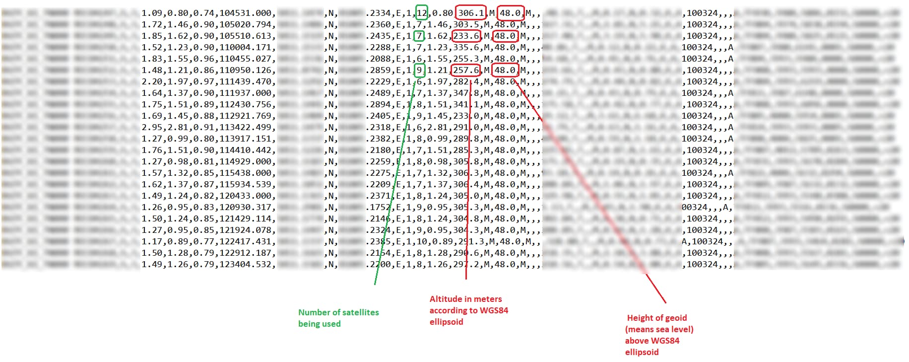
I and not only I (my friends too) have problem with MC60 - precision of altitude in meters according to WGS84 ellipsoid.
Data is read directly from MC60, without any processing, devices are in the same place all the time - result as in added picture. Height of geoid (means sea level) above WGS84 ellipsoid has 48m all the time, but altitude in meters according to WGS84 ellipsoid…what is wrong ? Thanks for any help.
Device with MC60 has been tested over 1 month.
Device is in the same place all the time. Battery voltage is ok ~4V. This is
Germany location, where altitude should be read as ~298m.
Any data from MC60 are writes to flash memory directly,
I use $GSA, $GGA, $VTG and $RMC NMEA protocol.
Device read information from MC60 with ~5 minutes periods.
As You see, there is some problem with accuracy, not altitude only.
All recorded data, with longitude and latitude are too differ from each other.
Differences between position readings are ~50-200m, but device
is in the same place all the time.
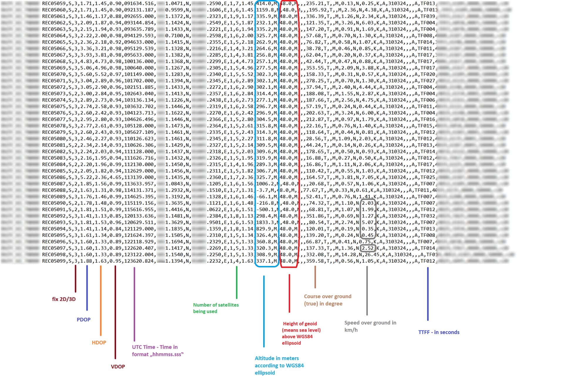
Height of geoid (48,0m) is stable, every record has 48,0m
Altitude…it’s not acceptable - the same place and read value between -500,1m
and 1833,3m! How it is possible ? Many records has 3D fix and >5 satellites.
The same question about speed over ground in km/h. How it is possible, that
device does not move and device ?
read value for example 5,07 km/h, other time 2,52 km/h ?
VRTC is active - there is voltage all the time on this pin, MC60 works with all-in-one
mode, but mcu turn off VBAT after read position and turn on it before read next data.